App Review: Outdoor Explorer TX
Summary: Outdoor Explorer TX is an app that you will likely get a lot of use out of. I’ve been playing with it for a while now, and honestly it’s now one of my ‘go to’ tools for when I’m out hiking. While the app allows for quite a few capabilities, two really stand out to me as the most important. One, the ability to find trails near your current location is super handy. If you finish up a hike and aren’t ready to wrap up the day, this feature has your back. Second, and more important to me, is the ability to find your location on the trail map in real time. Some trails like LBJ Grasslands aren’t always well marked, or if you are wanting to see a special feature at a state park, this feature helps you get to where you are going faster. I’ve really enjoyed using this app on my hikes, and I think you will too! Download and check it out!
Review
Outdoor Explorer TX is an app that I’ve been using now for over a year. It offers a mix of capabilities that I think are very useful, and in fact I wish I’d had this on multiple prior occasions in the past! The app has quite a few features, I’ll focus on all of them, but there are two specifically that I’ve found extremely useful. In fact there are a few specific cases I’ll point out later, where Outdoor Explorer TX could have specifically made a big difference in how my day went!
The app is available for both Android and IOS phones, since I use IOS devices, my review and screenshots will be from that version, any differences between the two operating systems should be minimal.
When you first open the app, the homepage will let you search at the top, or open a map to see various trails available within the app. Just below the search option, you can find nearby trails (always useful), a list of the National Parks mapped into the site, state parks mapped into the site, and city parks. Those last three are given alphabetical, vs geographic closeness. I like the nearby trails option, as many times I’ll be out and finish up at one spot, and may have time to hit someplace else in the area before heading home. This is a handy feature, and it does work. When I was hiking at some state parks this summer, the ‘nearby’ trails did change based on where I was.
The map function is also helpful, as it shows all the trails / parks that the developers have mapped into the app. They are color coded, so you can see what trails are city parks (blue) state parks (green) or national parks (red). You can zoom in as you normally would, and click on the pointers to see what trail each marker corresponds to, and then hit the back button to go back to the map.


What sets Outdoor Explorer apart from other trail mapping services is, you can see your progress on the trail itself while hiking.
Why is that important? I have an Apple Watch which is able to track how far my hikes are, and once I finish the hike, I can see a visual representation of that hike on a map, BUT I can only see the map once I complete it. Prior to finding Outdoor Explorer, I’ve recommended using MapMyFitness, which does let you see in real time your progress on a google maps view, but most trails aren’t laid out on Google Maps. Meaning if I look at my progress, I’m only seeing that red line across the green UI for parkland. Some trails are broken out on Google or Apple Maps, and if so you can track your progress using those apps. Most of the trails in our area are not, so in those cases, you may see your position, but it’s generally in a field of green with nothing to differentiate the trail. Outdoor Explorer solves this issue!
Here are some use cases for why Outdoor Explorer makes things easier for you:
1.) Health Emergencies: There was one time I was at Fort Worth Nature Preserve and stupidly took a ‘shortcut’ when I got hot (and didn’t bring water), and that shortcut was anything but a shortcut. This was one of the stupidest things I’d ever done, I was probably at risk of heat stroke given the heat (summer), no water (I’m an idiot) and going off trail (colossal idiot). Had I used Outdoor Explorer (or just had a general idea of where I was in relation to where I parked), I would have been much better off.
2.) Lost in Complex Trail System: At LBJ Grasslands, which is very large and you can easily get turned around, a friend and I were out on a trail and realized we weren’t where we thought we were. We had gone out on the Orange Trail to find the Haunted Woods, but then realized we weren’t where we thought we were on the map. Using Google Maps we were able to get back to our vehicle going directly to the TADRA location, but couldn’t tie our LBJ Grasslands map, to our location on Google Maps. If we’d had Outdoor Explorer, we would have been able to find out way back to a trail (our direct route led us into impassable areas that we had to figure out how to get around), AND we would have known when we had passed the haunted woods, or the other interestingly named spots in the grasslands.
3.) Find Important Trail Features: Finally a more recent example was when I was at Purtis Creek State Park exploring the trails. I didn’t bring a good bug repellant, so I was getting dive bombed by all kinds of blood sucking insects. I did want to see the special interest items listed on the state parks map, so using Outdoor Explorer I easily got to them, saw them, and got the hell out of there! Many of the state park maps do show interesting trail features on the map, so using Outdoor Explorer in those parks is a great way to make sure you don’t miss anything worth seeing!
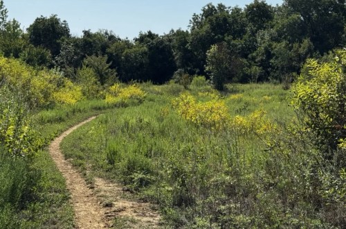
Below are a few examples of the geolocation capabilities of the app. The dot shows your position on the trail. The developers have mapped quite a few different trail maps onto the site, including some of the more artistic maps from Amy Martin’s Wild DFW book (check it out if you haven’t, it’s an amazing resource). While on a few maps the dot wasn’t 100% lined up on the trail from the map, it was definitely close enough and gave me the information that I needed.


There are other functions on the application as well, which I’ll be honest I haven’t used too much. Since I do have an Apple Watch which I used to record my hikes, I don’t record them using Outdoor Explorer. You can however record yourself should you want, and it will either use a local trail that you are near, or use the standard Apple Maps or Google Maps (depending on your OS), to record your distance. The app also has a cool function to log your trail, just like a paper digital field guide, so you can record the park name, location, trail name, hike time, distance and then make any notes that you’d like to record of your adventure. That’s a fantastic way to note down the kinds of animals, plants or sites that you encountered at this spot, especially for a later date when you may want to remember which trails you encountered a deer at.


Wrapping up this review, this is a fantastic and FREE app, that can do quite a few things for you, including one particularly important safety feature. Knowing where local trails are, being able to record and log your hikes is a great capability, but the ability to know exactly where you are on that trail could potentially be a life saving need. It’s also SO easy to use. The developers are constantly adding more to the application, and I highly recommend that you add it to your hiking tool kit!
Discover more from North Texas Trails
Subscribe to get the latest posts sent to your email.
Jeff
A long time native of North Texas, I love to hike and mountain bike in my spare time. I’m always looking for some place new to explore, which is why I’m doing this site.